Watching the Route du Rhum 2026 start: where to stand on shore
Updated on 1 November 2026
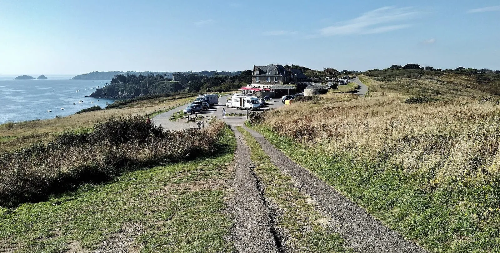

The Route du Rhum 2026 start is given on Sunday 1 November at 1:02 pm, off Saint-Malo. As at recent editions, the line lies off the Pointe du Grouin, at the mouth of the Mont-Saint-Michel bay: that is what the city’s practical guide states, and the viewpoints below are ranked on that basis. On shore, that leaves a whole coastline of viewpoints, unequal and unequally crowded.
Start-day weather, on the day. Sunshine, a north-easterly breeze of around ten knots and an almost flat sea at start time (AFP, morning of 1 November). Race director Francis Le Goff was expecting “around 12 knots” at the start, downwind, with the wind rising to 18 to 20 knots during the night (organisers, 31 October). Météo Consult, the race’s official forecaster, confirms a moderate north-easterly flow (31 October). Dress warmly: the north-easterly wind makes for a chilly morning on the headlands.
The viewpoints, from closest to widest
The Pointe du Grouin (Cancale): the closest point to the start line. This is where the fleet lines up and sets off; it is also the most coveted spot on the coast that day, with access roads saturating from early morning. Cancale town hall has published the 1 November arrangements; they include no spectator car park or shuttle, so come on foot, by bike or along the GR34. According to ici (Radio France), observation areas are set aside for the public, with parking towards Port-Mer; the Pointe du Meinga and the island of Cézembre are closed to the public, and an area is open at the Parc du Nicet, at the Pointe de la Varde.
- At the headland: traffic and parking are banned from 6 pm on Saturday 31 October to 6 pm on Sunday 1 November, except for accredited vehicles. On Sunday, from 6 am to 4 pm, the restricted sectors are closed to the public. The areas open to spectators are marked on the town hall’s map.
- According to the prefectures (statement of 30 October): meadows are set aside for the public, but the very tip of the headland is off limits. The Pointe du Meinga (Saint-Coulomb) and the Pointe de Rochefroide (Cancale) are closed to the public from 6 pm on Saturday. The RD 201 becomes one-way from Cancale towards Saint-Malo, the RD 355 stays two-way, and one route is reserved for emergency services. Parking is banned from 8 pm on Saturday along that route and the RD 355; it remains allowed on the landward verge of the RD 201. Hunting and carrying weapons are banned on the coastal strip north of the RD 201.
- Around it: access to the Pointe de la Roche Froide from the GR34 is banned from 6 pm on Saturday to 4 pm on Sunday. The lower car park at Port-Picain is reserved for emergency services on Sunday, and street trading is banned throughout the town.
- On the coast road (D201): one-way traffic from Cancale towards Saint-Coulomb on Sunday from 8 am to 4 pm, and no parking on the sea side until 4 pm on Sunday. The road, covered in sand by the storm, reopened on 27 October.
The Saint-Malo ramparts and beaches: you watch the last boats leave the docks in the early morning, then the fleet make for open water. Further from the line than the Grouin, but the corsair city’s atmosphere on start day cannot be replaced, and you come on foot from your accommodation.
Dinard and the Pointe du Décollé (Saint-Lunaire). The opposite shore: the boats cross your field of view as they leave the estuary. Often a little less dense than the Saint-Malo side.
The Pointe de la Varde and Rothéneuf. The heights east of Saint-Malo, between town and Grouin: a good view/access compromise if you are staying around Paramé.
Cap Fréhel. Further west, to see the fleet at full speed by mid-afternoon, from high cliffs that are usually less crowded. The 1 November arrangements have been published by the Côtes-d’Armor prefecture; Le Télégramme details them, with the Plévenon town hall. Between 19,000 and 20,000 people are expected.
- Roads closed to cars from 7 am to 7 pm: the Cape road (RD34), from Plévenon and from the Fréhel municipal campsite, and the RD117, between Plévenon and Fréhel and between the cape and Port à la Duc. They stay open to pedestrians, bikes and shuttles. Parking on them is banned from midday on Friday 30 October.
- Car parks and shuttles: four car parks, one at the Fréhel municipal campsite and three in Plévenon, including one for motorhomes, about 7,000 vehicles in all. Shuttles go up from 9:30 am to 12:45 pm and come back down from 1:45 to 6 pm. A shuttle for people with reduced mobility leaves from the campsite, and there is bike parking at La Teignouse.
- On site: the GR34 coastal path is closed between Fort la Latte and the cape, and between Plage de la Fosse and the lighthouse, as the heath was weakened by the July fire. Stay on the marked paths.
- Banned: animals, except guide dogs, and drones. There are no bins: take your rubbish home.
- If the start is postponed: shuttles could be reduced or cancelled.
All these places are on our map, each with its access notes.
How the day unfolds, seen from the coast
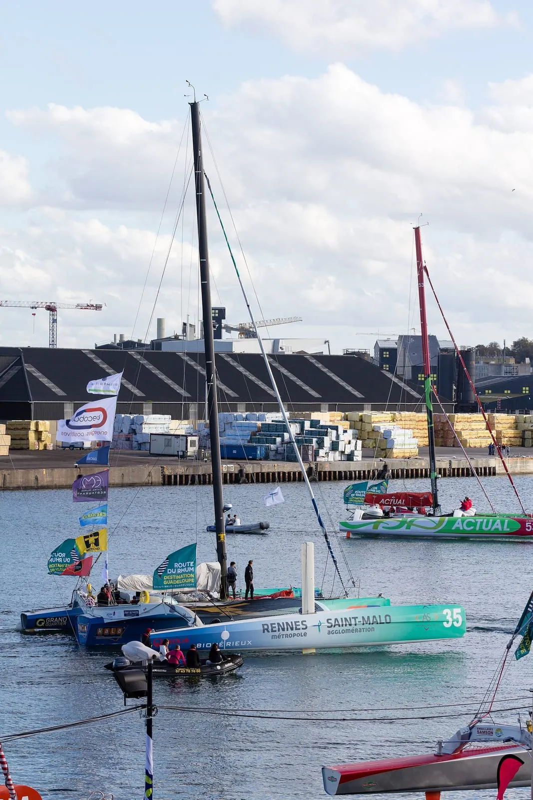
In reality, the start is prepared over three days. The departures from the docks are spread from Friday to Sunday: all eight Ultims went out on the evening of Friday 30 October; on Saturday 31, the Vintage multihulls and IMOCAs went out between 10:08 am and 12:08 pm, then the Ocean Fiftys and the last two IMOCAs between 6:42 and 8:42 pm; on Sunday the lock is open from 5:15 am to 12:45 pm for the Vintage monohulls, Class40s and support boats (city of Saint-Malo, 30 October; indicative times). Once out, the Ultims and IMOCAs spend their last nights at anchor off Dinard (the Ultims on moorings off the harbour, visible from the Pointe de la Vicomté, according to Le Télégramme), and the Ocean Fiftys at the Bas-Sablons harbour on Saturday night: from the Promenade du Clair de Lune you can see them at anchor on Saturday (organisers, 28 October). The Class40s therefore leave before daybreak; the full detail of the departures is on our village page. Late morning on 1 November is the transit: the fleet makes its way to the start area, escorted by an armada of spectator boats; from La Varde, Rothéneuf or the Décollé, this is when the water is busiest. At 1:02 pm, the gun, then the fleet stretches away offshore. Cap Fréhel takes over by mid-afternoon when the course passes within range, with the first Ultims already at full speed.
So choose your spot by the moment you want to catch: nobody sees all three. The Grouin regulars arrive at dawn; those on the ramparts come early for the last lock passages, then watch the fleet head out to sea.
The constraints to plan for
- The crowds: this is one of the busiest days of the decade on this coast. Everywhere, arrive very early; the phone network saturates.
- The city’s instructions (31 October): do not sit or climb on the rampart parapets or the edges of the Môle des Noires. Access to the Pointe de la Varde is restricted, and the city recommends the secured Parc du Nicet for watching the start. Flying leisure drones without authorisation is banned.
- Traffic: in Saint-Malo the plan is published (permit-only restricted zone in Intra-Muros and on the Sillon, park-and-ride at €10 per day with a free shuttle, extended MAT bus services); it is detailed on our getting there and parking page. On 1 November itself, buses run to a public holiday timetable. For the Pointe du Grouin and Cap Fréhel, the arrangements are detailed above.
- At sea: the Atlantic maritime prefecture and the Ille-et-Vilaine DDTM restated the arrangements on 29 October. The “race and passenger vessels” zone is closed to all leisure craft. To the south, in the “motor boaters” zone, every boat must motor, sailing boats included. Fishing and fishing gear (pots, nets) are banned throughout the regulated area. The State’s at-sea operation starts at 11 am, with checks from boats and from the air, and penalties can go as far as licence suspension. These rules stem from order no. 2026/160; on the morning of 31 October we had not found the order setting the exact zone limits online, and we could not read the document attached to the maritime prefecture’s statement. Information is broadcast on VHF channel 01. For spectator boats, two “nautical stadiums” are set up, one off the Grouin and one off Fréhel: each boat stays in the zone it chose and cannot follow the fleet out to sea (race director, 31 October).
- Staying in the village: on start day it opens from 10 am to 5 pm and screens the start on the main stage from 10 am to 4 pm, with screens throughout the village. It is the option for anyone who would rather not face the crowds on the headlands. The Sailorz Film Festival also announces a live screening at the Palais du Grand Large.
- Following from afar: France 3 and france.tv broadcast the start live from 12:50 pm, with a dedicated helicopter, Guadeloupe La 1ère also shows it live, and the organisers stream it on YouTube. In Dinard, the Balcon du Rhum screens it at the Palais des Arts, Salle Debussy, from 12 noon to 2 pm, free entry (town of Dinard, 31 October). The show “On refait le départ” airs from 6 to 7 pm on the race’s social media. The organisers publish the map of restricted-access areas (Grouin, Roche Froide, La Varde, Fréhel, Cézembre) on routedurhum.com; the Pointe du Meinga is closed to the public.
- The tide and coastal weather: headlands and the foreshore remain exposed places on a 1 November. If you go down towards the water, check the official SHOM tide times (widget below) and stay on the paths: the show is best watched from above.
Written and kept up to date by a Saint-Malo local in love with this coast. The story behind this guide



Check the official tide times on maree.shom.fr ↗
Frequently asked questions
What time does the Route du Rhum 2026 start?
The start is given on Sunday 1 November 2026 at 1:02 pm, off Saint-Malo. As at recent editions, the line lies off the Pointe du Grouin (Cancale), according to the practical guide published by the city. The boats do not all leave on the morning itself: the Ultims left the docks on the evening of Friday 30 October, the IMOCA, Ocean Fifty and Vintage multihulls went out on Saturday 31, and on Sunday morning only the Class40s and Vintage monohulls remain, with the lock open from 5:15 am to 12:45 pm according to the city (departures between 6:30 and 9:30 am according to the organisers). These times are indicative.
What is the best place to watch the start from shore?
There is no single best place, only trade-offs: the Pointe du Grouin is closest to the line, and the most coveted; the Saint-Malo ramparts and beaches see the last morning departures and the fleet heading out; the Dinard shore and the Pointe du Décollé watch the boats cross the estuary; Cap Fréhel sees them at full speed, later and with smaller crowds.
Can I drive to the Pointe du Grouin on start day?
At Cap Fréhel, yes, but not all the way: on 1 November the access roads to the cape are closed to cars from 7 am to 7 pm, with shuttles from four car parks in Plévenon and Fréhel. At the Pointe du Grouin, no: traffic and parking are banned there from 6 pm on Saturday 31 October to 6 pm on Sunday, except for accredited vehicles, and no car park or shuttle has been announced; parking is also banned from 8 pm on Saturday along the access roads, and the RD 201 becomes one-way from Cancale towards Saint-Malo (prefectures, 30 October). In Saint-Malo, the city's plan is online (restricted zone, park-and-ride, shuttles). One thing holds from one edition to the next: access to the headlands saturates very early in the morning. Plan to arrive well ahead, or come on foot or by bike from where you are staying.
Do I need binoculars?
Yes. The start line is offshore: from the ramparts, Dinard or Cap Fréhel the boats race several kilometres out, and even from the closest headlands, binoculars turn sails on the horizon into a readable race. A radio, or the organisers' live feed on your phone, supplies the commentary to go with it.